Geolocate

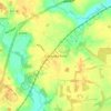
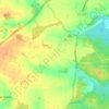
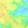
Lound topographic map

Click on the map to display elevation.

About this map

Name: Lound topographic map, elevation, terrain.

Location: Lound, East Suffolk, Suffolk, England, United Kingdom (52.52077 1.67983 52.54992 1.72647)

Average elevation: 13 m

Minimum elevation: -1 m

Maximum elevation: 26 m

Suffolk trails, hiking, mountain biking, running and outdoor activities

Other topographic maps

Click on a map to view its topography, its elevation and its terrain.
Henstead

United Kingdom > England > Suffolk > East Suffolk

Average elevation: 13 m

Hulver Street

United Kingdom > England > Suffolk > East Suffolk

Average elevation: 16 m

Sibton Green

United Kingdom > England > Suffolk > East Suffolk

Average elevation: 35 m

Sweffling

United Kingdom > England > Suffolk > East Suffolk

Average elevation: 32 m

Thorpeness

United Kingdom > England > Suffolk > East Suffolk

Average elevation: 4 m

Eastbridge

United Kingdom > England > Suffolk > East Suffolk

Average elevation: 10 m

Benhall Green

United Kingdom > England > Suffolk > East Suffolk

Average elevation: 21 m

Somerleyton

United Kingdom > England > Suffolk > East Suffolk

Average elevation: 9 m

Butley Abbey

United Kingdom > England > Suffolk > East Suffolk > Butley

Average elevation: 9 m

Hinton

United Kingdom > England > Suffolk > East Suffolk > Blythburgh

Average elevation: 19 m

Kelsale

United Kingdom > England > Suffolk > East Suffolk

Average elevation: 32 m

Wangford

United Kingdom > England > Suffolk > East Suffolk

Average elevation: 13 m

Wenhaston

United Kingdom > England > Suffolk > East Suffolk

Average elevation: 16 m

Thorpeness

United Kingdom > England > Suffolk > East Suffolk

Average elevation: 4 m

Wangford

United Kingdom > England > Suffolk > East Suffolk

Average elevation: 13 m

Sizewell

United Kingdom > England > Suffolk > East Suffolk > Leiston

Average elevation: 5 m

Sweffling

United Kingdom > England > Suffolk > East Suffolk

Average elevation: 32 m

Wangford

United Kingdom > England > Suffolk > East Suffolk

Average elevation: 13 m

Sizewell

United Kingdom > England > Suffolk > East Suffolk > Leiston

Average elevation: 5 m

Gear up for your next adventure:

🧗Locking Carabiners - Secure gear to your pack or for light technical use
⌚GPS Outdoor Watches - Watches with GPS tracking for hiking and exploration
🧺Ultralight Dry Bags - Organize and waterproof your gear inside your rucksack
🥤Hiking Water Bottles - Reusable bottles for hydration on the trail
🧥Packable Down Jackets - Lightweight warmth that compresses small in your bag

As an Amazon Associate, this site earns from qualifying purchases at no extra cost to you.