
Oświęcim topographic map
Interactive map
Click on the map to display elevation.
About this map
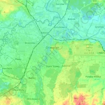
Name: Oświęcim topographic map, elevation, terrain.
Location: Oświęcim, Oświęcim County, Lesser Poland Voivodeship, Poland (50.00957 19.17785 50.05707 19.33445)
Average elevation: 239 m
Minimum elevation: 222 m
Maximum elevation: 281 m
Other topographic maps
Click on a map to view its topography, its elevation and its terrain.
Klein
Poland > Lesser Poland Voivodeship > Oświęcim County > Stawy Monowskie > Zalesie
Klein, Zalesie, Stawy Monowskie, gmina Oświęcim, Oświęcim County, Lesser Poland Voivodeship, Poland
Average elevation: 226 m