
Ban Tha Khum Ngoen topographic map
Interactive map
Click on the map to display elevation.
About this map
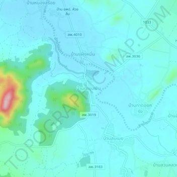
Name: Ban Tha Khum Ngoen topographic map, elevation, terrain.
Location: Ban Tha Khum Ngoen, Tha Khum Ngoen, Lamphun Province, Thailand (18.40581 98.93875 18.44581 98.97875)
Average elevation: 342 m
Minimum elevation: 315 m
Maximum elevation: 538 m
Other topographic maps
Click on a map to view its topography, its elevation and its terrain.