
Friedeburg topographic map
Interactive map
Click on the map to display elevation.
About this map
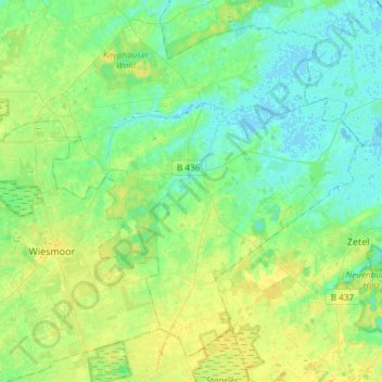
Name: Friedeburg topographic map, elevation, terrain.
Location: Friedeburg, Landkreis Wittmund, Lower Saxony, 26446, Germany (53.36214 7.67708 53.51679 7.97534)
Average elevation: 7 m
Minimum elevation: -2 m
Maximum elevation: 18 m
Other topographic maps
Click on a map to view its topography, its elevation and its terrain.