
Lebrade topographic map
Interactive map
Click on the map to display elevation.
About this map
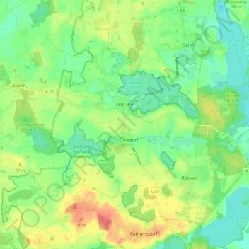
Name: Lebrade topographic map, elevation, terrain.
Location: Lebrade, Großer Plöner See, Plön, Schleswig-Holstein, Germany (54.18100 10.39105 54.24225 10.47410)
Average elevation: 42 m
Minimum elevation: 16 m
Maximum elevation: 82 m
Other topographic maps
Click on a map to view its topography, its elevation and its terrain.
Hundestrand Brasilien
Germany > Schleswig-Holstein > Plön > Schönberg (Holstein) > Schönberger Strand > Brasilien
Hundestrand Brasilien, Brasilien, Schönberger Strand, Schönberg (Holstein), Probstei, Plön, Schleswig-Holstein, 24217, Germany
Average elevation: 0 m
Grebin
Germany > Schleswig-Holstein > Plön
Grebin, Großer Plöner See, Plön, Schleswig-Holstein, Germany
Average elevation: 40 m