Geolocate

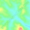
Moun topographic map

Click on the map to display elevation.

About this map

Name: Moun topographic map, elevation, terrain.

Location: Moun, Nuer, Gambela Region, Ethiopia (8.31976 33.27146 8.32864 33.28457)

Average elevation: 404 m

Minimum elevation: 400 m

Maximum elevation: 406 m

Other topographic maps

Click on a map to view its topography, its elevation and its terrain.

Periet

Ethiopia > Gambela Region

Average elevation: 430 m

Gambela National Park

Ethiopia > Gambela Region

Average elevation: 434 m

Gambela

Ethiopia > Gambela Region

Gambela (Amharic: ጋምቤላ), also spelled Gambella, is a city and separate woreda in Ethiopia and the capital of the Gambela Region. Located in Anyuak Zone, at the confluence of the Baro River and its tributary the Jajjabe, the city has a latitude and longitude of 8°15′N 34°35′E / 8.250°N…

Average elevation: 570 m
Ilubabor

Ethiopia > Gambela Region

Average elevation: 796 m

Gear up for your next adventure:

💧Hydration Reservoirs - Convenient water bladders for hands-free drinking on the move
📕Outdoor Navigation Books - Learn traditional and modern navigation techniques
👖Convertible Hiking Trousers - Versatile zip-off pants for changing mountain weather conditions
🧣Neck Gaiters - Versatile protection against wind and cold
🧭GPS Trackers - Tracking devices for safety and navigation

As an Amazon Associate, this site earns from qualifying purchases at no extra cost to you.