
North Mankato topographic map
Interactive map
Click on the map to display elevation.
About this map
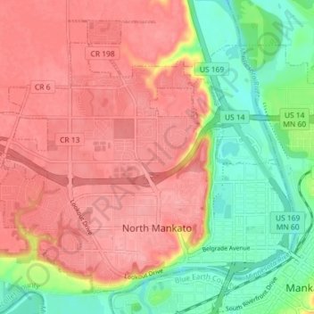
Name: North Mankato topographic map, elevation, terrain.
Average elevation: 275 m
Minimum elevation: 224 m
Maximum elevation: 311 m
Other topographic maps
Click on a map to view its topography, its elevation and its terrain.
Riverbend Estates
United States > Minnesota > Nicollet County > North Mankato
Average elevation: 265 m