
Thank you for supporting this site ❤️
Make a donation
Make a donation
Gear up for your next adventure:
As an Amazon Associate, this site earns from qualifying purchases at no extra cost to you.
Dhamaniya topographic map
Click on the map to display elevation.
Thank you for supporting this site ❤️
Make a donation
Make a donation
Gear up for your next adventure:
As an Amazon Associate, this site earns from qualifying purchases at no extra cost to you.
About this map
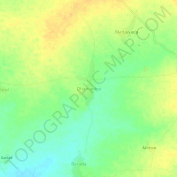
Name: Dhamaniya topographic map, elevation, terrain.
Location: Dhamaniya, Jawad Tehsil, Neemuch, Madhya Pradesh, India (24.55571 75.01252 24.59571 75.05252)
Average elevation: 486 m
Minimum elevation: 470 m
Maximum elevation: 498 m
Thank you for supporting this site ❤️
Make a donation
Make a donation
Gear up for your next adventure:
As an Amazon Associate, this site earns from qualifying purchases at no extra cost to you.