
Hurunui District topographic map
Interactive map
Click on the map to display elevation.
About this map
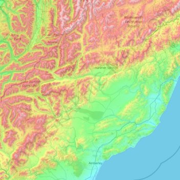
Name: Hurunui District topographic map, elevation, terrain.
Location: Hurunui District, Canterbury, Neuseeland (-43.24675 171.88239 -42.08785 173.50151)
Average elevation: 674 m
Minimum elevation: 0 m
Maximum elevation: 2,238 m
Other topographic maps
Click on a map to view its topography, its elevation and its terrain.
Faust
Neuseeland > Canterbury > Hurunui District
Faust, Hurunui District, Canterbury, Neuseeland
Average elevation: 1,397 m