Geolocate

Corvallis topographic map

Click on the map to display elevation.

About this map

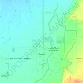
Name: Corvallis topographic map, elevation, terrain.

Location: Corvallis, Ravalli County, Montana, United States (46.30926 -114.12174 46.32723 -114.10828)

Average elevation: 1,060 m

Minimum elevation: 1,049 m

Maximum elevation: 1,090 m

Gear up for your next adventure:

📱Phone Mounts for Hiking - Secure mounts to carry your phone on trails
🛑Emergency Bivvy Bags - Heat-reflective survival bags for unexpected nights out
🧭GPS Trackers - Tracking devices for safety and navigation
🧗Locking Carabiners - Secure gear to your pack or for light technical use
🥫Expedition Meals - Lightweight, high-calorie nutrition for long-distance hikers

As an Amazon Associate, this site earns from qualifying purchases at no extra cost to you.