Geolocate

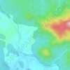
Curdi topographic map

Click on the map to display elevation.

About this map

Name: Curdi topographic map, elevation, terrain.

Location: Curdi, Sanguem, South Goa, Goa, India (15.14506 74.16674 15.18506 74.20674)

Average elevation: 49 m

Minimum elevation: 35 m

Maximum elevation: 176 m

Other topographic maps

Click on a map to view its topography, its elevation and its terrain.
Salaulim Dam

India > Goa > Sanguem > Sanguem

Average elevation: 39 m

Maulinguem

India > Goa > Sanguem

Average elevation: 101 m

Sanvordem

India > Goa > Sanguem

Average elevation: 28 m

Gear up for your next adventure:

📸Action Camera Chest Mounts - Record your ascent following topographic paths hands-free
🧢Waterproof Hiking Hats - Keep the rain off your face while studying topographic maps
🎒Hiking Daypacks (20L) - Compact backpacks for day trips and technical mountain ascents
🪢Paracord - Multi-purpose cord for camping and survival
💧Hydration Reservoirs - Convenient water bladders for hands-free drinking on the move

As an Amazon Associate, this site earns from qualifying purchases at no extra cost to you.