
Thank you for supporting this site ❤️
Make a donation
Make a donation
Gear up for your next adventure:
As an Amazon Associate, this site earns from qualifying purchases at no extra cost to you.
A Cabra topographic map
Click on the map to display elevation.
Thank you for supporting this site ❤️
Make a donation
Make a donation
Gear up for your next adventure:
As an Amazon Associate, this site earns from qualifying purchases at no extra cost to you.
About this map
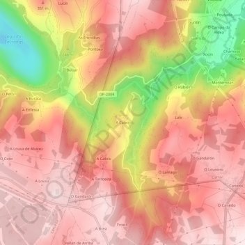
Name: A Cabra topographic map, elevation, terrain.
Location: A Cabra, Sumio, Carral, La Coruña, Galicia, 15187, España (43.15941 -8.41652 43.19941 -8.37652)
Average elevation: 293 m
Minimum elevation: 5 m
Maximum elevation: 431 m
Thank you for supporting this site ❤️
Make a donation
Make a donation
Gear up for your next adventure:
As an Amazon Associate, this site earns from qualifying purchases at no extra cost to you.