
Njeru topographic map
Interactive map
Click on the map to display elevation.
About this map
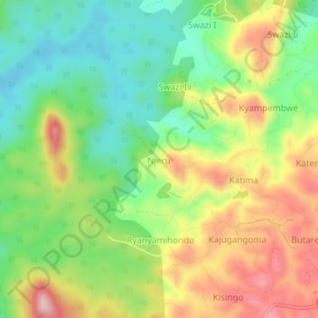
Name: Njeru topographic map, elevation, terrain.
Location: Njeru, Bushenyi, Western Region, Uganda (-0.47515 30.06608 -0.43515 30.10608)
Average elevation: 1,545 m
Minimum elevation: 1,444 m
Maximum elevation: 1,681 m
Other topographic maps
Click on a map to view its topography, its elevation and its terrain.