
Mazlaghan topographic map
Interactive map
Click on the map to display elevation.
About this map
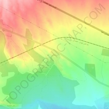
Name: Mazlaghan topographic map, elevation, terrain.
Location: Mazlaghan, بخش نوبران, Saveh County, Markazi Province, Iran (35.10030 49.71808 35.14030 49.75808)
Average elevation: 1,614 m
Minimum elevation: 1,536 m
Maximum elevation: 1,698 m
Other topographic maps
Click on a map to view its topography, its elevation and its terrain.
Gharqabad
Iran > Markazi Province > Saveh County
Gharqabad, بخش نوبران, Saveh County, Markazi Province, Iran
Average elevation: 1,543 m