
Thank you for supporting this site ❤️
Make a donation
Make a donation
Gear up for your next adventure:
As an Amazon Associate, this site earns from qualifying purchases at no extra cost to you.
Vamsadhara topographic map
Click on the map to display elevation.
Thank you for supporting this site ❤️
Make a donation
Make a donation
Gear up for your next adventure:
As an Amazon Associate, this site earns from qualifying purchases at no extra cost to you.
About this map
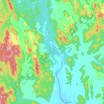
Name: Vamsadhara topographic map, elevation, terrain.
Location: Vamsadhara, Gudari, Rayagada District, Odisha, 765026, India (19.34434 83.70830 19.52909 83.77884)
Average elevation: 304 m
Minimum elevation: 115 m
Maximum elevation: 903 m
Thank you for supporting this site ❤️
Make a donation
Make a donation
Gear up for your next adventure:
As an Amazon Associate, this site earns from qualifying purchases at no extra cost to you.