
Constable 'The Haywain' viewing point topographic map
Interactive map
Click on the map to display elevation.
About this map
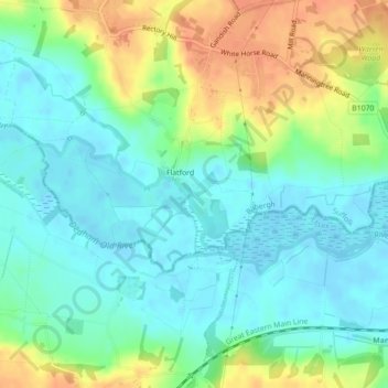
Name: Constable 'The Haywain' viewing point topographic map, elevation, terrain.
Average elevation: 15 m
Minimum elevation: -2 m
Maximum elevation: 43 m
Other topographic maps
Click on a map to view its topography, its elevation and its terrain.
Flatford
United Kingdom > England > Suffolk > Babergh > East Bergholt > Flatford
Average elevation: 22 m