
Kangeta topographic map
Interactive map
Click on the map to display elevation.
About this map
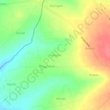
Name: Kangeta topographic map, elevation, terrain.
Location: Kangeta, Soroti City, Eastern Region, Uganda (1.76744 33.56612 1.80744 33.60612)
Average elevation: 1,096 m
Minimum elevation: 1,065 m
Maximum elevation: 1,129 m