
Bouillante topographic map
Interactive map
Click on the map to display elevation.
About this map
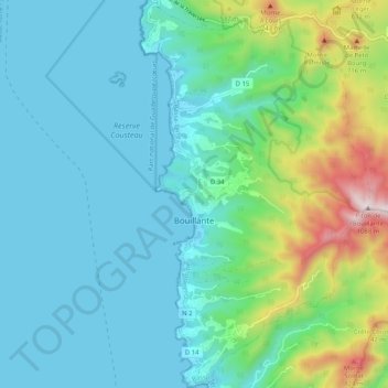
Name: Bouillante topographic map, elevation, terrain.
Location: Bouillante, Basse-Terre, Guadeloupe, 97125, France (16.08964 -61.79215 16.18778 -61.72358)
Average elevation: 213 m
Minimum elevation: 0 m
Maximum elevation: 1,053 m
Other topographic maps
Click on a map to view its topography, its elevation and its terrain.