
Thank you for supporting this site ❤️
Make a donation
Make a donation
Gear up for your next adventure:
As an Amazon Associate, this site earns from qualifying purchases at no extra cost to you.
Mundi topographic map
Click on the map to display elevation.
Thank you for supporting this site ❤️
Make a donation
Make a donation
Gear up for your next adventure:
As an Amazon Associate, this site earns from qualifying purchases at no extra cost to you.
About this map
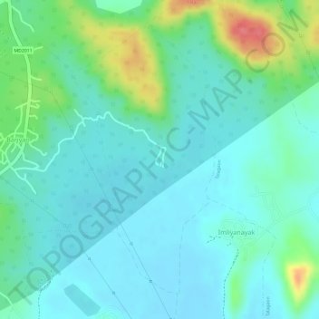
Name: Mundi topographic map, elevation, terrain.
Location: Mundi, Damoh Tahsil, Damoh District, Madhya Pradesh, India (23.70043 79.47734 23.72307 79.49067)
Average elevation: 364 m
Minimum elevation: 343 m
Maximum elevation: 422 m
Thank you for supporting this site ❤️
Make a donation
Make a donation
Gear up for your next adventure:
As an Amazon Associate, this site earns from qualifying purchases at no extra cost to you.