
Aguilar del Río Alhama topographic map
Interactive map
Click on the map to display elevation.
About this map
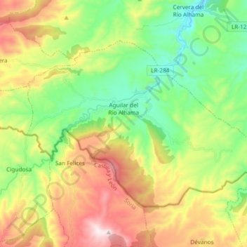
Name: Aguilar del Río Alhama topographic map, elevation, terrain.
Location: Aguilar del Río Alhama, La Rioja, 26530, Espagne (41.91903 -2.05125 41.99261 -1.90464)
Average elevation: 825 m
Minimum elevation: 521 m
Maximum elevation: 1,297 m