
Brütten topographic map
Interactive map
Click on the map to display elevation.
About this map
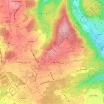
Name: Brütten topographic map, elevation, terrain.
Location: Brütten, Bezirk Winterthur, Zürich, 8311, Schweiz (47.46041 8.65147 47.49023 8.70009)
Average elevation: 581 m
Minimum elevation: 461 m
Maximum elevation: 655 m
Other topographic maps
Click on a map to view its topography, its elevation and its terrain.
Elgg
Schweiz > Zürich > Bezirk Winterthur
Elgg, Bezirk Winterthur, Zürich, Schweiz
Average elevation: 619 m