
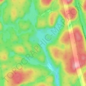
Lac Perreault topographic map
Interactive map
Click on the map to display elevation.
About this map
Name: Lac Perreault topographic map, elevation, terrain.
Average elevation: 335 m
Minimum elevation: 271 m
Maximum elevation: 404 m
Other topographic maps
Click on a map to view its topography, its elevation and its terrain.
Lac Sainte-Anne
Canada > Québec > Manicouagan > Rivière-aux-Outardes
Lac Sainte-Anne, Rivière-aux-Outardes, Manicouagan, Côte-Nord, Québec, Canada
Average elevation: 434 m