
Laki topographic map
Click on the map to display elevation.
Laki
In 1889, Stefan Verkovic (Topographical and Ethnographic Essay of Macedonia) noted Lika (Laki) as a village with 63 Bulgarian and 18 Turkish houses.
About this map
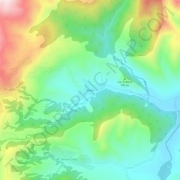
Name: Laki topographic map, elevation, terrain.
Location: Laki, Hadzhidimovo, Blagoevgrad, 2928, Bulgaria (41.44729 23.70000 41.48729 23.74000)
Average elevation: 805 m
Minimum elevation: 628 m
Maximum elevation: 1,159 m