Geolocate

Antap topographic map

Click on the map to display elevation.

About this map

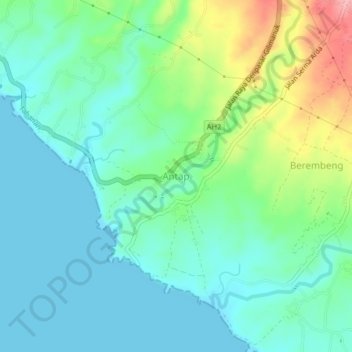
Name: Antap topographic map, elevation, terrain.

Location: Antap, Tabanan, Bali, Lesser Sunda Islands, Indonesia (-8.54770 114.98554 -8.50770 115.02554)

Average elevation: 32 m

Minimum elevation: 0 m

Maximum elevation: 123 m

Other topographic maps

Click on a map to view its topography, its elevation and its terrain.

Pujungan

Indonesia > Bali > Tabanan

Average elevation: 758 m

Gear up for your next adventure:

🦟Anti-Midge & Tick Repellent - Vital for hiking in the Scottish Highlands during summer
🎒Replacement Sternum Straps - Repair parts for hiking rucksacks
🔪Outdoor Multi-Tools - Versatile tools for gear repairs and food prep in the wild
👟Heavy Duty Boot Laces - Always carry a spare for your hiking footwear
🛌Insulated Sleeping Mats - Crucial thermal protection when sleeping on cold, uneven ground

As an Amazon Associate, this site earns from qualifying purchases at no extra cost to you.