Geolocate

Maddur topographic map

Click on the map to display elevation.

About this map

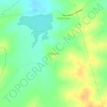
Name: Maddur topographic map, elevation, terrain.

Location: Maddur, Maddur mandal, Siddipet, Telangana, 502279, India (17.90684 79.02727 17.94684 79.06727)

Average elevation: 455 m

Minimum elevation: 440 m

Maximum elevation: 472 m

Gear up for your next adventure:

🔦Keychain LED Torches - Emergency backup light for finding gear in your pack
🔪Outdoor Multi-Tools - Versatile tools for gear repairs and food prep in the wild
🎒Hiking Child Carriers - Explore the outdoors with the whole family safely
🐕Dog Hiking Gear - Equipment for hiking safely with dogs
🛌Sleeping Bags - Warm and packable sleeping bags for outdoor nights

As an Amazon Associate, this site earns from qualifying purchases at no extra cost to you.