Cul-du-Qu'vau topographic map
Interactive map
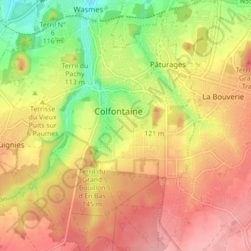
Click on the map to display elevation.
About this map
Name: Cul-du-Qu'vau topographic map, elevation, terrain.
Average elevation: 97 m
Minimum elevation: 35 m
Maximum elevation: 142 m

Click on the map to display elevation.
Name: Cul-du-Qu'vau topographic map, elevation, terrain.
Average elevation: 97 m
Minimum elevation: 35 m
Maximum elevation: 142 m