Geolocate

Nossen topographic map

Click on the map to display elevation.

About this map

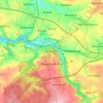
Name: Nossen topographic map, elevation, terrain.

Location: Nossen, Meißen, Saxony, 01683, Germany (51.01659 13.25807 51.09659 13.33807)

Average elevation: 273 m

Minimum elevation: 202 m

Maximum elevation: 354 m

Gear up for your next adventure:

📷Outdoor Action Cameras - Cameras designed for hiking and adventure
🧼Technical Clothing Wash - Special soap to clean and restore waterproof membranes
👕Technical Hiking Tees - Moisture-management for high-exertion climbs
🩹Hiking First Aid Kits - Compact medical kits tailored for trail injuries and emergencies
📻Hand-Crank Emergency Radios - Stay updated on weather warnings in remote areas

As an Amazon Associate, this site earns from qualifying purchases at no extra cost to you.