
Mossendjo topographic map
Interactive map
Click on the map to display elevation.
About this map
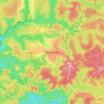
Name: Mossendjo topographic map, elevation, terrain.
Location: Mossendjo, Niari Department, Congo-Brazzaville (-2.98553 12.67528 -2.90553 12.75528)
Average elevation: 447 m
Minimum elevation: 370 m
Maximum elevation: 517 m
Other topographic maps
Click on a map to view its topography, its elevation and its terrain.