Geolocate

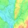
Charlton topographic map

Click on the map to display elevation.

About this map

Name: Charlton topographic map, elevation, terrain.

Location: Charlton, Hartlebury, Wychavon, Worcestershire, England, DY11 7YE, United Kingdom (52.31818 -2.26679 52.35818 -2.22679)

Average elevation: 49 m

Minimum elevation: 12 m

Maximum elevation: 90 m

Other topographic maps

Click on a map to view its topography, its elevation and its terrain.
Gear up for your next adventure:

🌦️Portable Weather Meters - Handheld tools for monitoring weather conditions
🔥Reusable Hand Warmers - Maintain dexterity in your fingers for precise map handling
🧥Softshell Jackets - Breathable jackets for active outdoor use
👟Heavy Duty Boot Laces - Always carry a spare for your hiking footwear
🛌Sleeping Bags - Warm and packable sleeping bags for outdoor nights

As an Amazon Associate, this site earns from qualifying purchases at no extra cost to you.