Geolocate

Castroverde topographic map

Click on the map to display elevation.

About this map
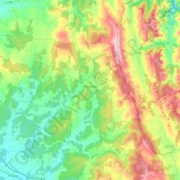
Name: Castroverde topographic map, elevation, terrain.

Location: Castroverde, Lugo, Galicia, Spain (42.93859 -7.43813 43.11439 -7.24337)

Average elevation: 623 m

Minimum elevation: 412 m

Maximum elevation: 1,026 m

Other topographic maps

Click on a map to view its topography, its elevation and its terrain.

Quinte

Spain > Galicia > Lugo

Average elevation: 454 m

Quintián

Spain > Galicia > Lugo

Average elevation: 490 m

Outeiro Pequeno

Spain > Galicia > Lugo > Portomarín

Average elevation: 530 m

Gear up for your next adventure:

🛌Insulated Sleeping Mats - Crucial thermal protection when sleeping on cold, uneven ground
🔋Power Banks - Portable chargers for long outdoor trips
🥾Hiking Boot Waterproofing Wax - Maintain the lifespan of your leather trekking boots
👕Technical Hiking Tees - Moisture-management for high-exertion climbs
🔦LED Camping Lanterns - Illumination for reading maps inside your tent at night

As an Amazon Associate, this site earns from qualifying purchases at no extra cost to you.