Geolocate

Ota topographic map

Click on the map to display elevation.

About this map

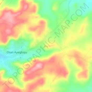
Name: Ota topographic map, elevation, terrain.

Location: Ota, Boluwaduro, Osun State, Nigeria (7.93000 4.78000 7.97000 4.82000)

Average elevation: 541 m

Minimum elevation: 455 m

Maximum elevation: 621 m

Gear up for your next adventure:

🪢Paracord - Multi-purpose cord for camping and survival
🛰️Outdoor GPS Navigation - Navigation devices for remote and off-grid areas
🔭Compact Hiking Binoculars - Lightweight optics for scouting terrain and spotting wildlife
🧼Biodegradable Soap - Leave-no-trace hygiene for multi-day mountain treks
🥤Hiking Water Bottles - Reusable bottles for hydration on the trail

As an Amazon Associate, this site earns from qualifying purchases at no extra cost to you.