Geolocate

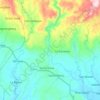
Lucena topographic map

Click on the map to display elevation.

About this map

Name: Lucena topographic map, elevation, terrain.

Location: Lucena, Prosperidad, Agusan del Sur, Caraga, 8500, Philippines (8.54682 125.85325 8.58682 125.89325)

Average elevation: 36 m

Minimum elevation: 27 m

Maximum elevation: 47 m

Other topographic maps

Click on a map to view its topography, its elevation and its terrain.
Maug River

Philippines > Agusan del Sur > Prosperidad

Average elevation: 221 m

Gear up for your next adventure:

🔥Reusable Hand Warmers - Maintain dexterity in your fingers for precise map handling
🗺️Ordnance Survey Maps - Essential paper maps for hiking across the UK national parks
🥾Men's Waterproof Hiking Boots - Durable footwear with deep lugs for muddy and rocky UK terrains
⌚GPS Outdoor Watches - Watches with GPS tracking for hiking and exploration
🐕Hiking Dog Harnesses - Rugged harnesses for taking your companion on mountain trails

As an Amazon Associate, this site earns from qualifying purchases at no extra cost to you.