Geolocate

Monte Penna topographic map

Click on the map to display elevation.

About this map

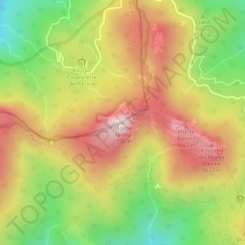
Name: Monte Penna topographic map, elevation, terrain.

Location: Monte Penna, Tornolo, Parma, Emilia-Romagna, Italy (44.48124 9.49283 44.48134 9.49293)

Average elevation: 1,409 m

Minimum elevation: 1,101 m

Maximum elevation: 1,697 m

Gear up for your next adventure:

🕶️Glacier Goggles - Maximum protection for high-altitude snow topography
🧤Thermal Touchscreen Gloves - Stay warm while operating your GPS or smartphone camera
🧣Fleece Neck Warmers - Extra insulation for winter topographic surveys
📦Dry Bags - Waterproof bags to protect gear from rain
🌄Outdoor Binoculars - Compact binoculars for landscape observation

As an Amazon Associate, this site earns from qualifying purchases at no extra cost to you.