Geolocate

Debring topographic map

Click on the map to display elevation.

About this map

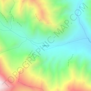
Name: Debring topographic map, elevation, terrain.

Location: Debring, Khalsi tehsil, Leh District, Ladakh, India (33.94966 76.57945 33.98966 76.61945)

Average elevation: 4,380 m

Minimum elevation: 3,900 m

Maximum elevation: 5,280 m

Gear up for your next adventure:

🥾Walking Shoes - Lightweight walking shoes for countryside and coastal paths
🔋Rechargeable Batteries - Eco-friendly power for headlamps and older GPS units
🎒Hiking Backpacks - Comfortable backpacks for day hikes and multi-day treks
👖Convertible Hiking Trousers - Versatile zip-off pants for changing mountain weather conditions
🔦Keychain LED Torches - Emergency backup light for finding gear in your pack

As an Amazon Associate, this site earns from qualifying purchases at no extra cost to you.