Geolocate

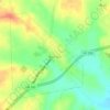
Daniels topographic map

Click on the map to display elevation.

About this map

Name: Daniels topographic map, elevation, terrain.

Location: Daniels, Washington County, Texas, United States (30.17883 -96.22579 30.21883 -96.18579)

Average elevation: 55 m

Minimum elevation: 47 m

Maximum elevation: 82 m

Other topographic maps

Click on a map to view its topography, its elevation and its terrain.
Brenham

United States > Texas > Washington County

Average elevation: 98 m

Burton

United States > Texas > Washington County

Average elevation: 132 m

Burton

United States > Texas > Washington County

Average elevation: 132 m

Brenham

United States > Texas > Washington County > Brenham

Average elevation: 98 m

Burton

United States > Texas > Washington County

Average elevation: 132 m

Gear up for your next adventure:

🧢Thermal Beanie Hats - Prevent heat loss from the head in windy summit conditions
🧢Hiking Hats - Sun and weather protection for outdoor walks
🧦Hiking Socks - Breathable socks designed to prevent blisters on long walks
📍Handheld GPS Navigators - Reliable satellite navigation for hiking and off-road exploration
🧥Packable Down Jackets - Lightweight warmth that compresses small in your bag

As an Amazon Associate, this site earns from qualifying purchases at no extra cost to you.