
Punta Oriental topographic map
Interactive map
Click on the map to display elevation.
About this map
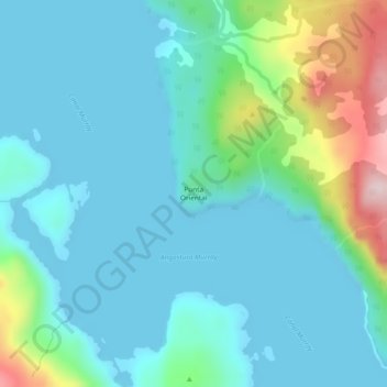
Name: Punta Oriental topographic map, elevation, terrain.
Average elevation: 65 m
Minimum elevation: 0 m
Maximum elevation: 338 m
Other topographic maps
Click on a map to view its topography, its elevation and its terrain.
Isla London
Chili > Magellan et Antarctique chilien > Cabo de Hornos
Isla London, Cabo de Hornos, Province de l'Antarctique chilien, Magellan et Antarctique chilien, Chili
Average elevation: 56 m