
Givat Yoav topographic map
Interactive map
Click on the map to display elevation.
About this map
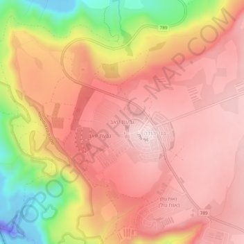
Name: Givat Yoav topographic map, elevation, terrain.
Average elevation: 245 m
Minimum elevation: -111 m
Maximum elevation: 370 m
Other topographic maps
Click on a map to view its topography, its elevation and its terrain.
Avnay Eitan
Israel > North District > Golan Regional Council
Avnei Eitan (Hebrew: אַבְנֵי אֵיתָן) is an Israeli settlement organized as a moshav in the southern Golan Heights, located at an elevation of 385 meters (1,263 ft) above sea level. Located to the east of the Sea of Galilee, it falls under the municipal jurisdiction of Golan Regional Council. In…
Average elevation: 384 m