Geolocate

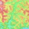
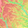
Colatina topographic map

Click on the map to display elevation.

About this map

Name: Colatina topographic map, elevation, terrain.

Location: Colatina, Espírito Santo, Southeast Region, Brazil (-19.71266 -40.85890 -19.28678 -40.47661)

Average elevation: 205 m

Minimum elevation: 17 m

Maximum elevation: 891 m

Other topographic maps

Click on a map to view its topography, its elevation and its terrain.

Praia de Ubu

Brazil > Espírito Santo > Anchieta

Average elevation: 8 m

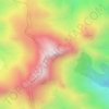
Pico da Bandeira

Brazil > Espírito Santo > Ibitirama

Pico da Bandeira, or Bandeira Peak (Portuguese for Flag Peak, pronounced [ˈpiku dɐ bɐ̃ˈdejɾɐ]), is the third highest mountain in Brazil, situated on the border of Espírito Santo and Minas Gerais states. It is the highest point in both states. It was considered the highest mountain in Brazil until 1965,…

Average elevation: 2,487 m
Terra Fria

Brazil > Espírito Santo > Castelo

Average elevation: 858 m

Tijuco Preto

Brazil > Espírito Santo > Domingos Martins

Average elevation: 936 m

Meia-Légua

Brazil > Espírito Santo > Santa Leopoldina

Average elevation: 455 m

Jaguaré

Brazil > Espírito Santo > Jaguaré

Average elevation: 62 m

Alto Santa Maria

Brazil > Espírito Santo > Santa Teresa

Average elevation: 335 m

Gear up for your next adventure:

🎒Replacement Sternum Straps - Repair parts for hiking rucksacks
🔋Power Banks - Portable chargers for long outdoor trips
🪓Outdoor Multitools - Versatile tools for hiking and camping
🥄Titanium Camping Sporks - The ultimate lightweight utensil for trail meals
🧺Microfibre Travel Towels - Fast-drying and compact towels for wild swimming and camping

As an Amazon Associate, this site earns from qualifying purchases at no extra cost to you.