
Thank you for supporting this site ❤️
Make a donation
Make a donation
Gear up for your next adventure:
As an Amazon Associate, this site earns from qualifying purchases at no extra cost to you.
Incisa topographic map
Click on the map to display elevation.
Thank you for supporting this site ❤️
Make a donation
Make a donation
Gear up for your next adventure:
As an Amazon Associate, this site earns from qualifying purchases at no extra cost to you.
About this map
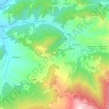
Name: Incisa topographic map, elevation, terrain.
Location: Incisa, Montacuto, Alessandria, Piedmont, 15056, Italy (44.74975 9.07687 44.78975 9.11687)
Average elevation: 533 m
Minimum elevation: 333 m
Maximum elevation: 898 m
Thank you for supporting this site ❤️
Make a donation
Make a donation
Gear up for your next adventure:
As an Amazon Associate, this site earns from qualifying purchases at no extra cost to you.