Geolocate

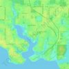
Pretty Bayou topographic map

Click on the map to display elevation.

About this map

Name: Pretty Bayou topographic map, elevation, terrain.

Location: Pretty Bayou, Panama City, Bay County, Florida, United States (30.19260 -85.67799 30.19478 -85.67590)

Average elevation: 10 m

Minimum elevation: 3 m

Maximum elevation: 15 m

Other topographic maps

Click on a map to view its topography, its elevation and its terrain.
Millville

United States > Florida > Bay County > Panama City

Average elevation: 9 m

Millville

United States > Florida > Bay County > Panama City

Average elevation: 9 m

Gear up for your next adventure:

📢Survival Whistles - Essential safety gear for signaling for help in mountain fog
🥾Hiking Boot Waterproofing Wax - Maintain the lifespan of your leather trekking boots
🌦️Portable Weather Meters - Handheld tools for monitoring weather conditions
🚲Bikepacking Frame Bags - Storage for tools and navigation gear on long off-road rides
🥤Collapsible Water Bottles - Save space in your rucksack as you consume your water

As an Amazon Associate, this site earns from qualifying purchases at no extra cost to you.