
Thusis topographic map
Interactive map
Click on the map to display elevation.
About this map
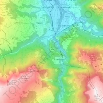
Name: Thusis topographic map, elevation, terrain.
Location: Thusis, Viamala, Grisons, 7430, Switzerland (46.64833 9.40893 46.71587 9.51400)
Average elevation: 1,326 m
Minimum elevation: 650 m
Maximum elevation: 2,387 m
Other topographic maps
Click on a map to view its topography, its elevation and its terrain.
Andeer
Switzerland > Grisons > Viamala
Andeer, Viamala, Grisons, Switzerland
Average elevation: 1,996 m
Juf
Switzerland > Grisons > Viamala > Avers
Juf, Avers, Viamala, Grisons, 7448, Switzerland
Average elevation: 2,469 m