Geolocate

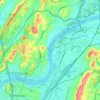
Valley Village topographic map

Click on the map to display elevation.

About this map

Name: Valley Village topographic map, elevation, terrain.

Location: Valley Village, Chattanooga, Hamilton County, East Tennessee, Tennessee, 00003, United States (35.03063 -85.37413 35.07063 -85.33413)

Average elevation: 260 m

Minimum elevation: 189 m

Maximum elevation: 565 m

Other topographic maps

Click on a map to view its topography, its elevation and its terrain.
Gear up for your next adventure:

🎒Hiking Child Carriers - Explore the outdoors with the whole family safely
⌚GPS Outdoor Watches - Watches with GPS tracking for hiking and exploration
🧼Camping Hygiene Kits - Compact hygiene essentials for outdoor stays
🗺️Topographic Maps - Detailed maps showing elevation and terrain features
🧰Survival Kits - Emergency tools for remote environments

As an Amazon Associate, this site earns from qualifying purchases at no extra cost to you.