Geolocate

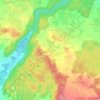
Gräfelfing topographic map

Click on the map to display elevation.

About this map

Name: Gräfelfing topographic map, elevation, terrain.

Location: Gräfelfing, Landkreis München, Bavaria, 82166, Germany (48.10676 11.39996 48.13756 11.46567)

Average elevation: 543 m

Minimum elevation: 526 m

Maximum elevation: 564 m

Other topographic maps

Click on a map to view its topography, its elevation and its terrain.

Eglfing

Germany > Bavaria > Landkreis München > Haar

Average elevation: 540 m

Martinsried

Germany > Bavaria > Landkreis München > Planegg

Average elevation: 549 m

Hofolding

Germany > Bavaria > Landkreis München

Average elevation: 609 m

Holzhausen

Germany > Bavaria > Landkreis München

Average elevation: 663 m

Deisenhofen

Germany > Bavaria > Landkreis München > Oberhaching

Average elevation: 592 m

Gear up for your next adventure:

🖼️Topographic Map Art - Decorative 3D-effect posters of famous UK peaks and regions
🧭Emergency Beacons - Safety beacons for remote outdoor locations
🎒Hiking Child Carriers - Explore the outdoors with the whole family safely
🥾Trekking Poles - Poles to improve stability on uneven terrain
🥾Hiking Boot Waterproofing Wax - Maintain the lifespan of your leather trekking boots

As an Amazon Associate, this site earns from qualifying purchases at no extra cost to you.