
Neunkirch topographic map
Interactive map
Click on the map to display elevation.
About this map
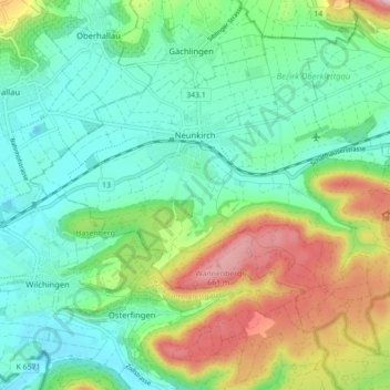
Name: Neunkirch topographic map, elevation, terrain.
Location: Neunkirch, Bezirk Oberklettgau, Schaffhausen, 8213, Schweiz (47.65685 8.46283 47.70507 8.55045)
Average elevation: 487 m
Minimum elevation: 396 m
Maximum elevation: 692 m
Other topographic maps
Click on a map to view its topography, its elevation and its terrain.
Randen
Schweiz > Schaffhausen > Bezirk Oberklettgau
Randen, Bezirk Oberklettgau, Schaffhausen, Schweiz
Average elevation: 650 m