
Berdejo topographic map
Interactive map
Click on the map to display elevation.
About this map
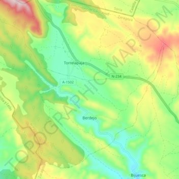
Name: Berdejo topographic map, elevation, terrain.
Location: Berdejo, Comunidad de Calatayud, Zaragoza, Aragón, España (41.54296 -1.99503 41.60013 -1.90778)
Average elevation: 1,061 m
Minimum elevation: 917 m
Maximum elevation: 1,285 m