Geolocate

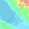
Santa Rosa Sur topographic map

Click on the map to display elevation.

About this map

Name: Santa Rosa Sur topographic map, elevation, terrain.

Location: Santa Rosa Sur, Jose Panganiban, Camarines Norte, Bicol Region, 4606, Philippines (14.23953 122.70434 14.27953 122.74434)

Average elevation: 37 m

Minimum elevation: 3 m

Maximum elevation: 263 m

Other topographic maps

Click on a map to view its topography, its elevation and its terrain.
Gear up for your next adventure:

🛰️Handheld GPS Devices - Reliable GPS units for hiking and outdoor navigation
🔋Power Banks - Portable chargers for long outdoor trips
🗺️Ordnance Survey Maps - Essential paper maps for hiking across the UK national parks
🩹Hiking First Aid Kits - Compact medical kits tailored for trail injuries and emergencies
🧼Camping Hygiene Kits - Compact hygiene essentials for outdoor stays

As an Amazon Associate, this site earns from qualifying purchases at no extra cost to you.