
Allenby topographic map
Click on the map to display elevation.
About this map
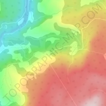
Name: Allenby topographic map, elevation, terrain.
Average elevation: 850 m
Minimum elevation: 660 m
Maximum elevation: 1,028 m
Other topographic maps
Click on a map to view its topography, its elevation and its terrain.
Lightning Lake
Canada > British Columbia > Regional District of Okanagan-Similkameen > Area H (Manning Park/Tulameen/Siwash)
Average elevation: 1,418 m
Chapman Lake
Canada > British Columbia > Regional District of Okanagan-Similkameen > Area H (Manning Park/Tulameen/Siwash)
Average elevation: 1,669 m
Allison Lake
Canada > British Columbia > Regional District of Okanagan-Similkameen > Area H (Manning Park/Tulameen/Siwash)
Average elevation: 1,141 m
Rampart Lake
Canada > British Columbia > Regional District of Okanagan-Similkameen > Area H (Manning Park/Tulameen/Siwash)
Average elevation: 1,333 m
Chain Lake
Canada > British Columbia > Regional District of Okanagan-Similkameen > Area H (Manning Park/Tulameen/Siwash)
Average elevation: 1,165 m