Geolocate

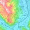
Grabserberg topographic map

Click on the map to display elevation.

About this map

Name: Grabserberg topographic map, elevation, terrain.

Location: Grabserberg, Grabs, Wahlkreis Werdenberg, St. Gallen, 9472, Switzerland (47.16353 9.40399 47.20353 9.44399)

Average elevation: 768 m

Minimum elevation: 452 m

Maximum elevation: 1,296 m

Other topographic maps

Click on a map to view its topography, its elevation and its terrain.

Grabs

Switzerland > St. Gallen > Wahlkreis Werdenberg

Average elevation: 916 m

Sevelen

Switzerland > St. Gallen > Wahlkreis Werdenberg

Average elevation: 781 m

Wartau

Switzerland > St. Gallen > Wahlkreis Werdenberg

Average elevation: 950 m

Gear up for your next adventure:

🧊Personal Water Filters - Drink safely from mountain streams marked on your map
🖼️Topographic Map Art - Decorative 3D-effect posters of famous UK peaks and regions
☕Insulated Travel Mugs - Keep drinks hot while surveying the landscape from a summit
🔦Outdoor Torches - Reliable torches for night navigation
🗺️Topographic Maps - Detailed maps showing elevation and terrain features

As an Amazon Associate, this site earns from qualifying purchases at no extra cost to you.