Forest-in-Teesdale topographic map
Interactive map
Click on the map to display elevation.
About this map
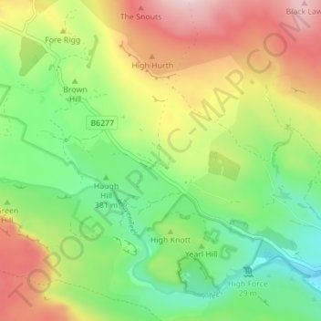
Name: Forest-in-Teesdale topographic map, elevation, terrain.
Average elevation: 418 m
Minimum elevation: 289 m
Maximum elevation: 597 m

Click on the map to display elevation.
Name: Forest-in-Teesdale topographic map, elevation, terrain.
Average elevation: 418 m
Minimum elevation: 289 m
Maximum elevation: 597 m