Geolocate

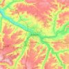
Neuvillette topographic map

Click on the map to display elevation.

About this map

Name: Neuvillette topographic map, elevation, terrain.

Location: Neuvillette, Amiens, Somme, Hauts-de-France, Metropolitan France, 80600, France (50.19777 2.30149 50.22043 2.32838)

Average elevation: 135 m

Minimum elevation: 90 m

Maximum elevation: 152 m

Other topographic maps

Click on a map to view its topography, its elevation and its terrain.

Petit-Camon

France > Hauts-de-France > Somme > Camon

Average elevation: 73 m

Amiens

France > Hauts-de-France > Somme > Amiens

Average elevation: 86 m

Larronville

France > Hauts-de-France > Somme > Rue

Average elevation: 8 m

Gear up for your next adventure:

🚶Walking Pedometers - Simple distance tracking for casual trail walkers
🔥Emergency Fire Starters - Reliable ignition tools for survival situations in damp conditions
🐕Dog Hiking Gear - Equipment for hiking safely with dogs
🕶️Glacier Goggles - Maximum protection for high-altitude snow topography
🥾Walking Shoes - Lightweight walking shoes for countryside and coastal paths

As an Amazon Associate, this site earns from qualifying purchases at no extra cost to you.